Secrets of NYC
✉️ The Lost Pneumatic Tube System at the NYSE
Long before fiber optics and wireless networks, bursts of compressed air kept Wall Street moving.
Long before fiber optics and wireless networks, bursts of compressed air kept Wall Street moving.

A new exhibit explores the unrealized, extant, and lost projects of this prolific NYC artist!


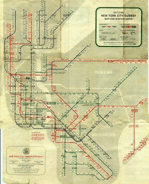
Here, in chronological order, a roundup of historical, replicas and future iterations of the New York City subway map. Until the 1940s, the subway was run by three competing companies: Interborough Rapid Transit (IRT), Brooklyn-Manhattan Transit (BMT), and the Independent Subway (IND). Watch the lines spread like a vine over the geography of the city, see the system unify into one beast, and observe how graphic design evolves with the aesthetics of the decades. These maps and many more are available here, at nycSubway.org.

This map was part of a souvenir publication released for the opening of the IRT (Interborough Rapid Transit) subway in 1904
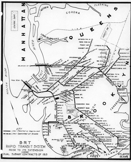
1912 BRT (Brooklyn Rapid Transit) Route
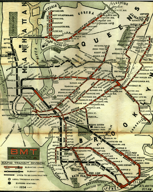
1924 BMT (Brooklyn-Manhattan Transit) Subway-Elevated Route

1933 BMT Subway-Elevated Route. “Map dated by presence of Radio City Music Hall, which opened in December 1932.”
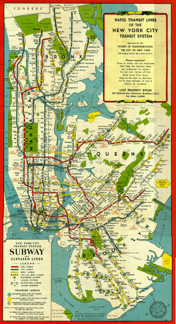
1948 System Map: IRT & BMT lines both shown
1959 System Map: The Beginning of the New Layout
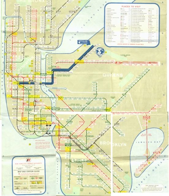
1964 System Map: The World’s Fair Map
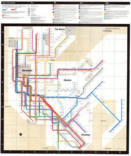
1972 Map
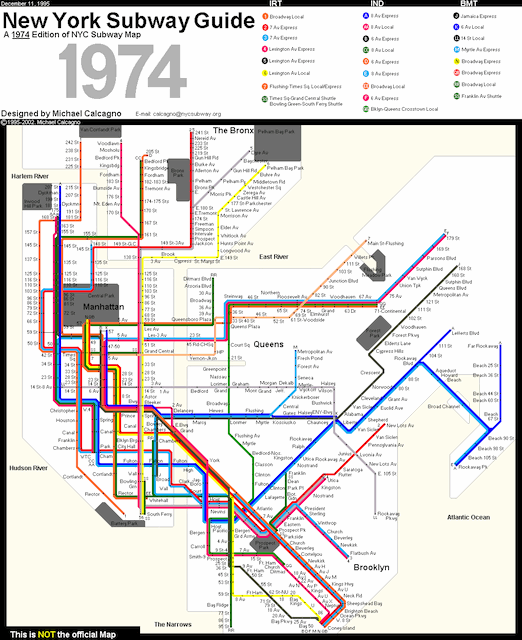
1974 System Map: A Hand-Drawn Replica by Michael Calcagno
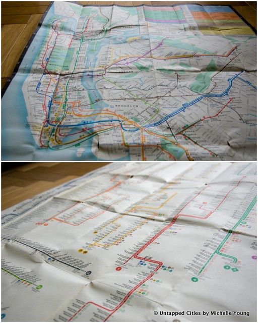
Authentic 1979 MTA Map, a find at Brazenhead Books
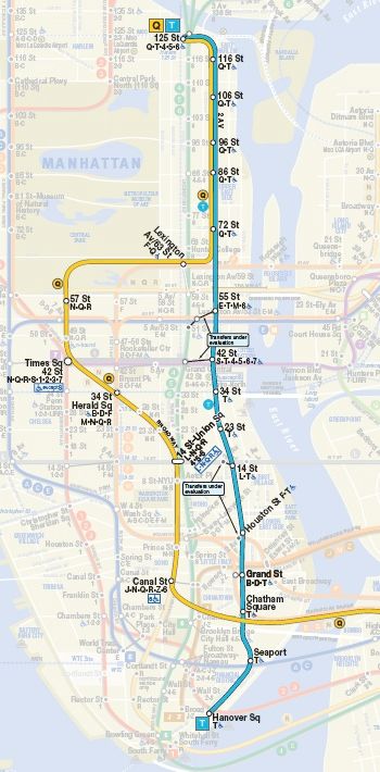
The MTA’s Second Avenue Subway Map with the new T Train and Q train extension
Check out our Photos of the Second Avenue Subway Construction. Get in touch with the author @untappedmaps. See more maps in our Fun Maps column.

Subscribe to our newsletter