Architecture
🏠 A Private Island of Frank Lloyd Wright Homes in the Hudson Valley
Tucked away on a heart-shaped island, two unique homes are waiting for you to come visit!
Tucked away on a heart-shaped island, two unique homes are waiting for you to come visit!

Find out what you can see from the 26th floor on an exclusive access tour!
Explore "Democracy Matters" on a docent led tour!

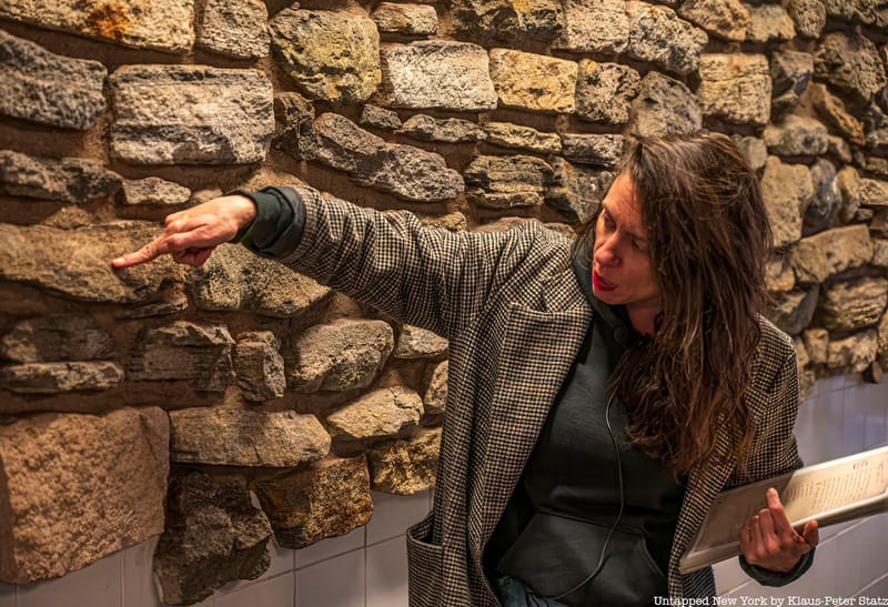
Uncover the original Dutch street names of NYC and see how the names of streets in the Lower Manhattan street grid evolved!


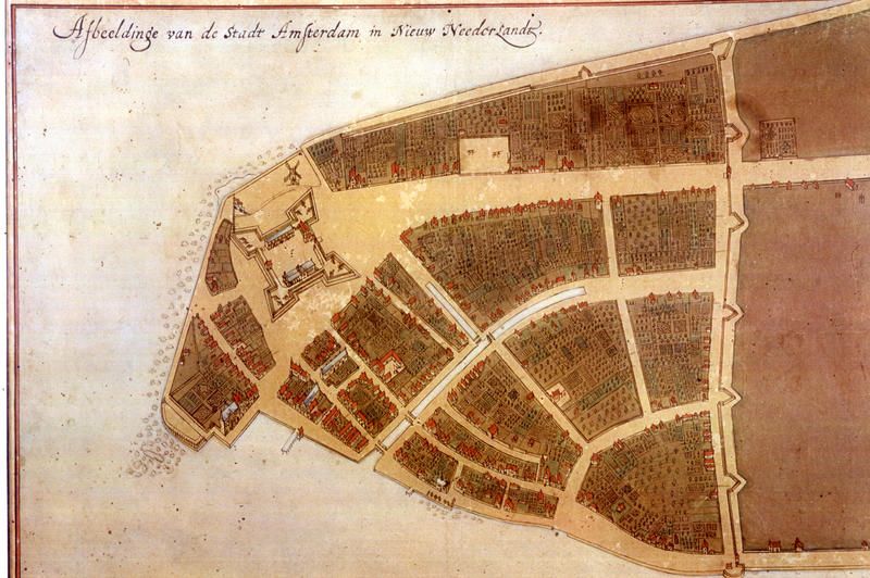
Begijn Gracht. Paerel Straet. Brugh Straet. You may not recognize these Dutch street names of NYC, but these are the names of streets you have likely walked on in Lower Manhattan. Today they are called Beaver Street, Pearl Street, and Bridge Street. When Dutch settlers colonized the southern tip of Manhattan and established the colony of New Amsterdam, they created the island’s first street grid. These Dutch streets were forever cemented in the makeup of New York City when they became a designated New York City landmark in 1983. While the Dutch grid itself has remained largely as it was in the 17th century, when the British took control of New Amsterdam in 1664 and changed the colony’s name to New York – in honor of the royal proprietor the Duke of York, later King James II – the Dutch street names changed as well. Some street names were loosely translated from Dutch to English and some were changed entirely. Here, we trace the evolution of 10 New York City street names from the original Dutch colonial grid and explain how they got the names they have today!
Broadway is the oldest thoroughfare in New York City and one of the oldest in the country. The street was originally an Indian thoroughfare called Wickquasgeck (Wick-kwas-geck), meaning “birch-bark country” and its route ran through the Bronx and Westchester to the north of present-day Albany. Under Dutch colonial rule, Broadway ran from Fort Amsterdam – the site of the Museum of the American Indian today – to Wall Street at the northern border of the colony. The Dutch name for the street was De Heere Straat which translates to “Gentleman’s Way,” but in the common vernacular, it was referred to as “brede weg,” or “broad road” since it was the widest street in New Amsterdam. The eventual English-translated name became Broadway. Under the British, the name of Fort Amsterdam at the southern end of Broadway was also changed. It became Fort James.
You can walk the original Dutch colonial street grid, starting at the former site of Fort Amsterdam, and physically touch remnants of New York’s colonial history on an upcoming Remnants of Dutch New Amsterdam Walking Tour!
Smee Straet has proved to be one of the most debated Dutch street names in New York. One theory suggests that “smee” means “smithy,” referring to a blacksmith. Another suggests it means oily or slick. On a recent Remnants of Dutch New Amsterdam Tour, a Dutch guest further clarified that “smee” means fat or lard. This might suggest that there was perhaps a dairy on the street from which the street name was derived. In the early 1700s, this street was renamed in honor of the British royal family, the House of Hanover. This was the house of which King George III was a member. (It was a likeness of King George III that was torn down from the nearby Bowling Green and melted into bullets during the Revolutionary War.)
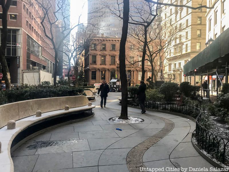
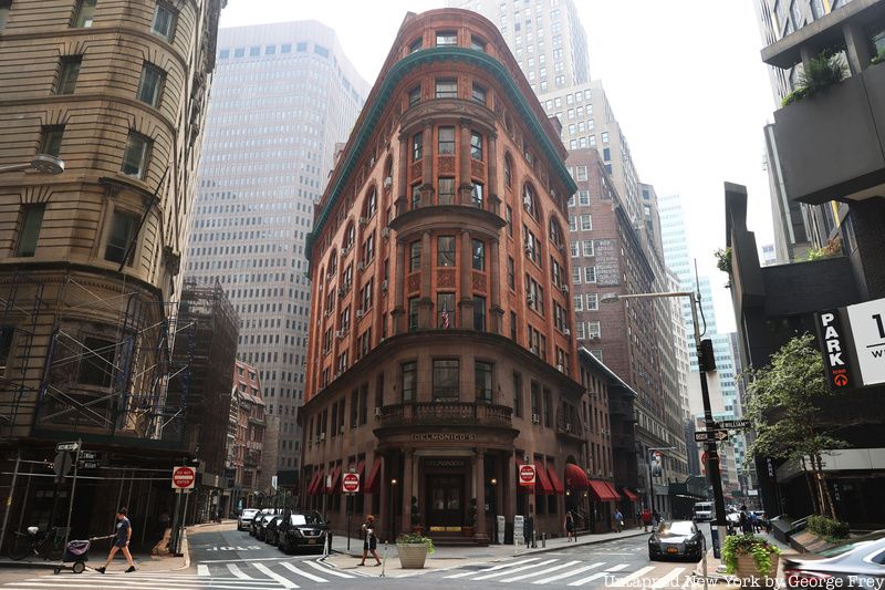
The Hanover name was carried over to Hanover Square which was created in the early 18th century. The square used to be referred to as the slip since it served as a slip on the original shoreline of Manhattan. While there was much turmoil in Lower Manhattan between the British and Americans in the throes of the Revolutionary War, today there is a symbol of the friendship between the two countries. The Queen Elizabeth II Garden in Hanover Square was created in memory of the British victims of 9/11. The park pays tribute to the counties of England with an inscribed stone ribbon that winds through the sidewalk of the park and the sixty-seven British victims are memorialized by sixty-seven bamboo shrubs that line the park.
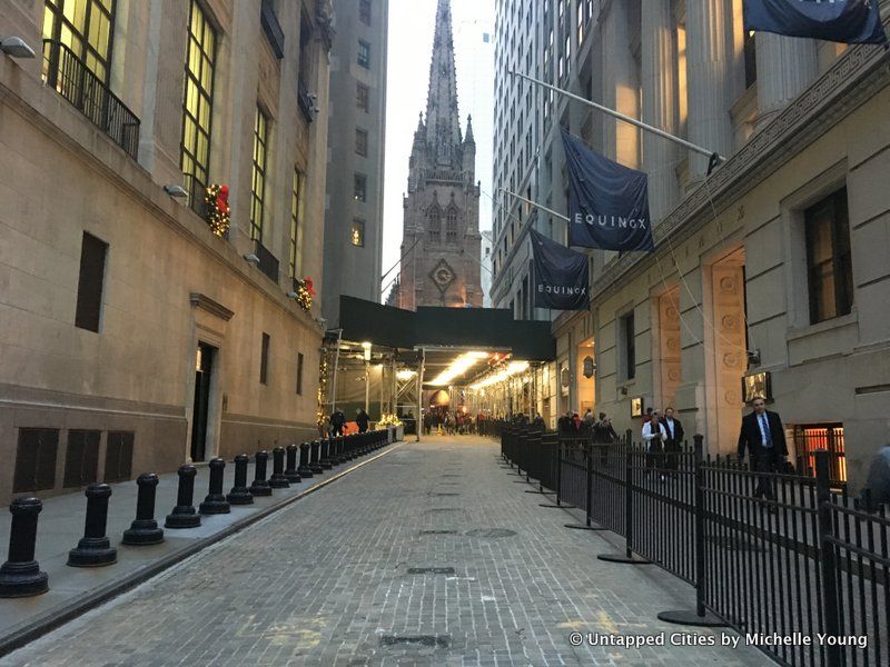
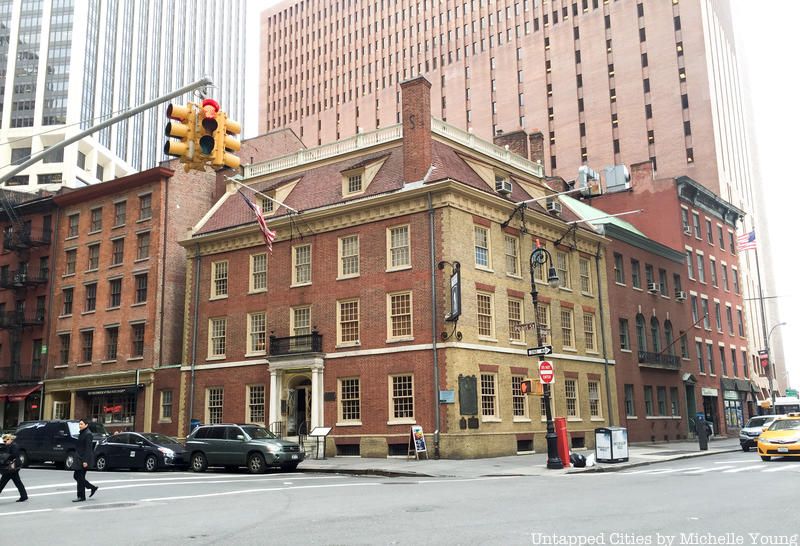
Wall Street marked the northern border of New Amsterdam and the site of an actual wall. The wall stretched from the East River to the Hudson and was put in place to protect the Dutch colony from Native Americans and the British. It is estimated that the wall was built in either 1639 or 1653.
The street that ran alongside the wall was called Het Cingel which translates to the “girdle” or “rampart.” According to the Landmarks Preservation Commission, the British changed the Dutch name to “Wall Street” in 1685. Running down Wall Street today you can see wooden block pavers embedded in the cobblestone streets that indicate the site of the former wall.
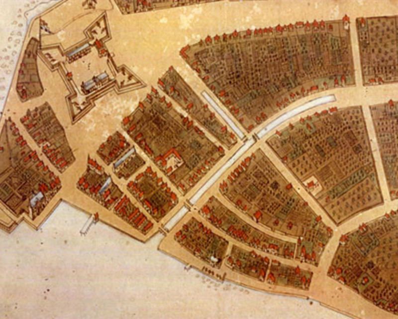
During the time of Dutch Colonial rule, Broad Street wasn’t always a street. In a 19th-century map of 1642 New Amsterdam, this pathway was marked as the “Common Ditch.” For a time, what we now know as Broad Street was Heere Gracht which translates to “The Lords or Gentleman’s Canal.” This canal flowed from Pearl to Beaver Streets and emptied into the East River from 1646 to 1676.
When the English took over, the canal was filled in and the street created on top of it was dubbed Broad Street in 1692. Due to the fact that the street was once a canal, it was wider than usual. Another street that derives its name from the time of the Heere Gracht is Bridge Street. Known in 1658 as “Brugh Straet,” this Dutch street was a bridge over the canal and its current name comes from the translation.
The present Beaver Street encompasses three New York City colonial streets with Dutch street names that were Beaver Gracht, Prince Straet, and Sloat Lane. The original name of the street was Begijn Gracht which loosely translates to “lay nun.” The street contained the Beaver Gracht, or Beaver Canal in 1658 which was later filled in.
Beaver Street was extended to its current length in 1837. Its name, which dates to before 1693, signifies the importance of beavers to the Dutch colony. Beaver pelts were a vital part of the city’s fur trade.
This article is available to Supporter tier members and higher. Join for just $5/month to unlock 12,000+ stories about New York City.
Become a SupporterSubscribe to our free newsletters
Free Newsletters
Get the best stories and things to do sent straight to your inbox.