
Free
"The Harlem Trilogy: Cool Machine" Downtown Walking Tour
Celebrate the release of Colson Whitehead's new NYC-set novel, "Cool Machine," on a walking tour of Manhattan!

Locate the private streets of NYC on an interactive map!

New York’s history is laid out in its streets. Most of those streets are open to the public. But throughout Manhattan, the city’s oldest borough, you can find private streets that were drawn and erased from the city’s official maps throughout history.
Simply, private streets are streets that are not officially mapped by the City of New York, according to Hector Rivera, Topographic Associate at the Manhattan Borough President’s office. The owners of property on private streets are responsible for maintaining the street and extending utilities from the nearest mapped street into the local buildings. Some of those private streets are residential, some are alleyways connecting two mapped streets, and others are old dead end streets that were once used for parking horses and buggies.
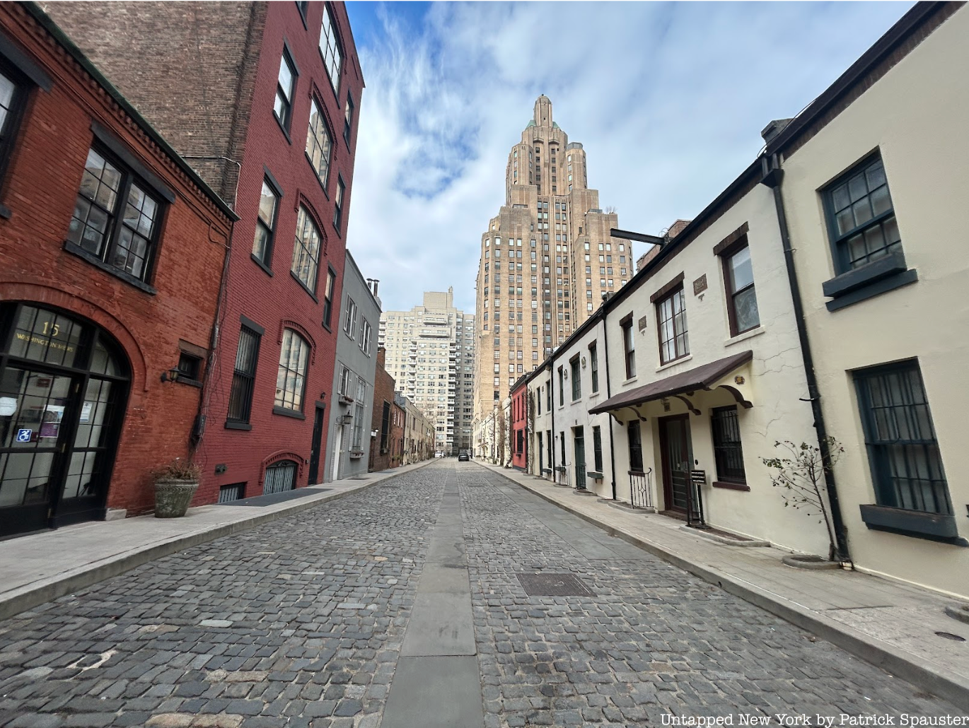
Some of the private streets in Manhattan are well known, like the Washington Mews, part of New York University’s Greenwich Village campus. Others are more hidden. Our map lets you browse 37 private streets in Manhattan from a list in the city’s archives from 1975.
Manhattan's private streets as of 1975. List and descriptions courtesy of Manhattan Borough President's office.
Sometimes property owners want to take a street off the map, or merge blocks to create a superblock. It can give builders more land to build and let them build higher and denser. The strategy has been used recently, like when the city unmapped West 32nd street between 10th and 11th Avenues and replaced it with a private loop to make room for a Hudson Yards shopping mall and the public plaza that holds the Vessel.
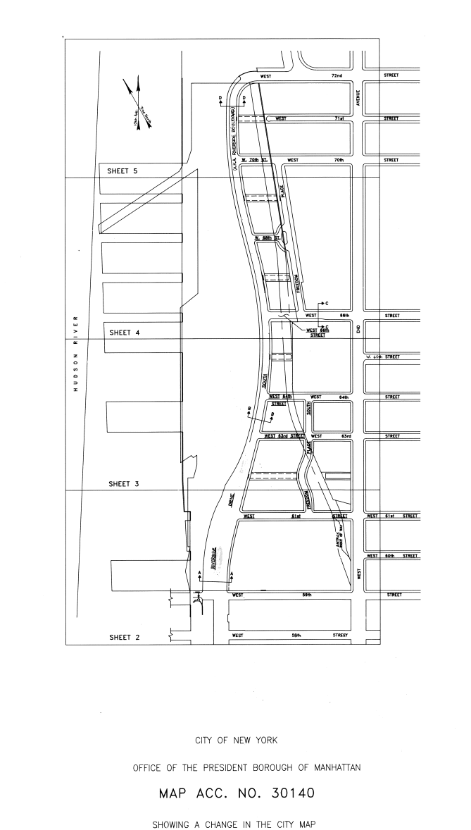
Anytime someone wants to change the city’s street map, it triggers the city’s public land use review process, called the Uniform Land Use Review Procedure (ULURP). That was the case for Freedom Place South, a small private street on Manhattan’s Upper West Side that’s part of Waterline Square. There, developers manage private streets that extend Freedom Place from 61st down to 59th, and added a turnaround that extends 60th street to bisect the extension.
When changing the city map, the community gets to weigh in. The local community board reviews and makes a recommendation. So does the borough president’s office. But the ultimate power to change the map lies with the city’s planning commission and city council, who have to vote to change the map and create a private street.
One usually doesn’t get to make a private street without some concessions. At Waterline Square, they built a new public school for the community, and had to provide school bus access to the private street. They also had to be up to code and ensure the fire department would have access.
Getting rid of the street also increased the square footage of the lot. And since how densely you can build in New York City is directly tied to how big your lot is, it enabled the builders to use the extra square footage that used to be street in making their buildings taller and offering even more spectacular views of the Hudson River.
Some of New York’s quaintest private streets look no different than a public street. And they are open to the public most of the time. But Hector Rivera of the Manhattan Borough President’s office warns that if your private street is too open to the public, the city could reclaim it.
Unless a private street closes to the public for at least one day a year, the city can reclaim it through a court action called a court counsel opinion, which basically claims that the street is private only in name.
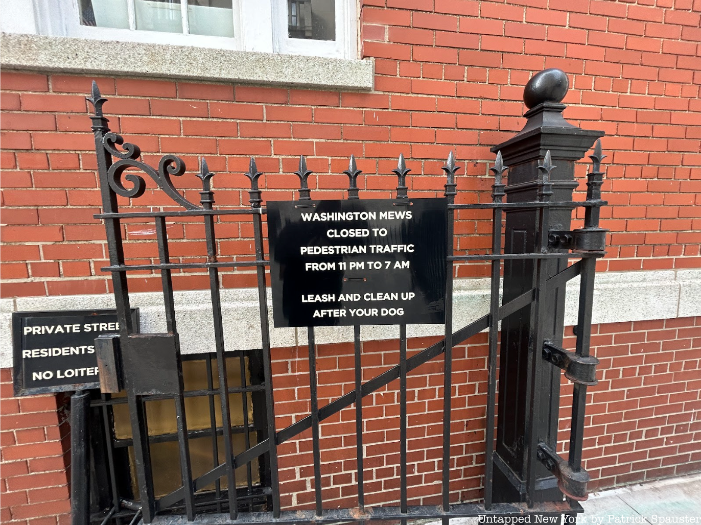
“There are several streets that look like they're alleyways, but they're closed once a year just so that there won't be any court counsel opinion opposing them,” said Rivera. Rivera added that reclaiming a street using a court counsel opinion is exceedingly rare—it hasn’t happened in his time with the office—and the city would probably need a good reason to remap a street.
The legal vestige means that private streets like the Washington Mews need to keep private hours, or risk reclamation by the city. The street today is part tourist attraction but still functional, including office spaces and faculty housing for New York University.
In 2012, the city sought to reactivate a strip of land along Delancey Street at the Manhattan base of the Williamsburg bridge. That strip of land which would become Essex Crossing—now home to Essex Market, a movie theater, a museum and school, housing, and retail space—was once bounded by parking lots and private streets.
Broome and Clinton Streets in September 2007. Google Maps
The city de-mapped Broome Street in 1970 and the road fell into disrepair, becoming little more than an extension of the adjacent parking lot, and filling up with potholes.
When the city reactivated Essex Crossing in 2012, they brought the street back under city control, fixed it up, and built massive retail and housing developments on the former parking lots.
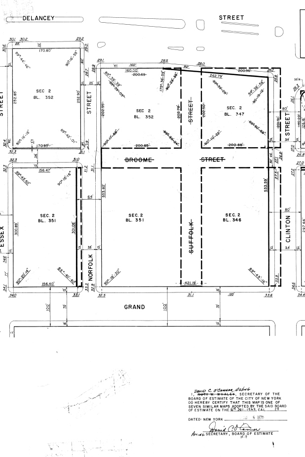
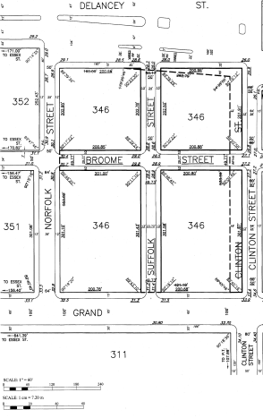
Left: Broome Street is de-mapped between Norfolk and Clinton in February 1970 and then remapped (right) in 2012. Courtesy of Manhattan Borough President's Office
Manhattan’s private streets hold a few secrets about the city’s history. They also show how the street map is a living entity that adapts as the city changes.
Next, check out 15 of NYC’s one-block streets, or 6 hidden alleys in Greenwich Village.
Subscribe to our free newsletters
Free Newsletters
Get the best stories and things to do sent straight to your inbox.